|
|
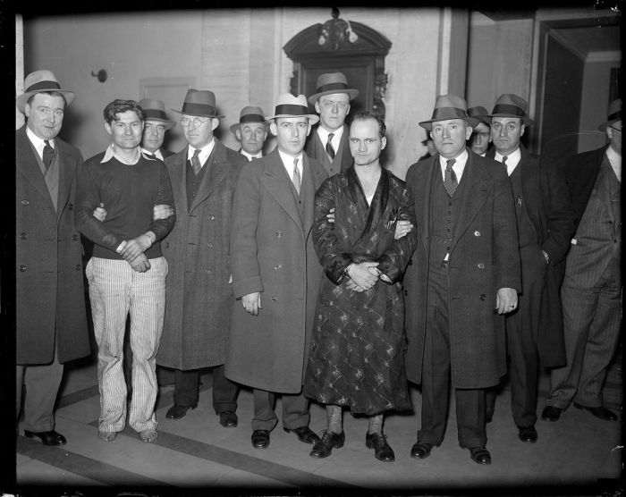
History: Boston Police, Behind The Badge, 1930s, Boston, Massachusetts, United States
|
Downtown Boston's streets were not organized on a grid, but grew in a meandering organic pattern from early in the 17th century. They were created as needed, and as wharves and landfill expanded the area of the small Boston peninsula. Along with several rotaries, roads change names and lose and add lanes seemingly at random. By contrast, streets in the Back Bay, East Boston, the South End, and South Boston do follow a grid system.
Boston is the eastern terminus of cross-continent I-90, which in Massachusetts runs along the Massachusetts Turnpike. Originally known as the Circumferential Highway, Route 128 carries I-95 over a portion of its route west and north of the city. U.S. 1 and I-93 run concurrently north to south through the city from Charlestown to Dorchester, joined by Massachusetts Route 3 after the Zakim Bridge over the Charles River. The elevated portion of the Central Artery, which carried these routes through downtown Boston, was replaced with the O'Neill Tunnel during the Big Dig, substantially completed in early 2006.
Nearly a third of Bostonians use public transit for their commute to work. The Massachusetts Bay Transportation Authority (MBTA) operates what was the first underground rapid transit system in the United States and is now the fourth busiest rapid transit system in the country, having been expanded to 65.5 miles (105 km) of track, reaching as far north as Malden, as far south as Braintree, and as far west as Newton—collectively known as the "T". The MBTA also operates the nation's seventh busiest bus network, as well as water shuttles, and the nation's busiest commuter rail network outside of New York City or Chicago, totaling over 200 miles (320 km), extending north to the Merrimack Valley, west to Worcester, and south to Providence.
Amtrak's Northeast Corridor and Chicago lines originate at South Station and stop at Back Bay. Fast Northeast Corridor trains, which serve New York City, Washington, D.C., and points in between, also stop at Route 128 Station in the southwestern suburbs of Boston. Meanwhile, Amtrak's Downeaster service to Maine originates at North Station.
|
|


