|
|
Kinzua Bridge, Mount Jewett, McKean County, Pennsylvania
|
As of 2009, Kinzua Bridge State Park is a 329-acre (133 ha) Pennsylvania state park surrounding the bridge and the Kinzua Valley. The park is located off of U.S. Route 6 north of Mount Jewett in Hamlin and Keating Townships. A scenic overlook within the park allows views of the fallen bridge and of the valley, and is also a prime location to view the fall foliage during the first two weeks of October. The park has a shaded picnic area with a centrally located modern restroom. Prior to the bridge's collapse, visitors were allowed on or under the bridge and hiking was allowed in the valley around the bridge. In September 2002 the bridge was closed even to pedestrian traffic. About 100 acres (40 ha) of Kinzua Bridge State Park are open to hunting. Common game species are turkey, bear and deer.
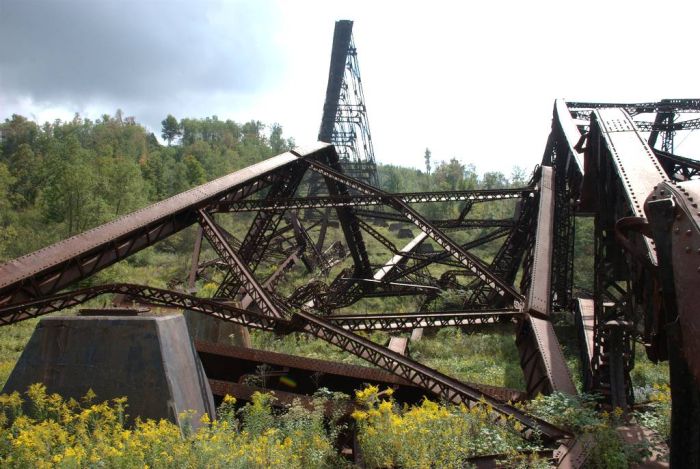
Destruction
On July 21, 2003, a tornado struck the Kinzua Bridge, snapping and uprooting nearby trees, as well as causing 11 of the 20 bridge towers to collapse. There were no human deaths or injuries. The tornado was produced by a mesoscale convective system (MCS), a complex of strong thunderstorms, that had formed over an area that included eastern Ohio, western Pennsylvania, western New York, and southern Ontario. The MCS traveled east at around 40 miles per hour (64 km/h). As the MCS crossed northwestern Pennsylvania, it formed into a distinctive comma shape. The northern portion of the MCS contained a long-lived mesocyclone, a thunderstorm with a rotating updraft that is often conducive to tornados.
|
|