|
|
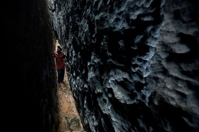
Tsingy De Bemaraha, Melaky Region, Madagascar
|
There is a very high rate of species endemicity in all the western dry deciduous forests of Madagascar, for both flora and fauna; this rate is thought to be higher than for the eastern rainforests, although the biodiversity, while extremely high, is slightly less than the eastern counterparts. Geologically the tsingy formations have numerous subterranean caverns (used by early tribesmen) and karst formations, which provide underground water storage.
Also Ankarana Reserve is a small vegetated plateau in northern Madagascar with elevations that exceed 1,220 metres (4,000 ft) above sea level. It is composed of 150-million-year-old limestone. With an average annual rainfall of 1,800 metres (5,900 ft) illimeters (70 inches (1,800 mm) ches), the underlying rocks are susceptible to erosion, thereby producing caves and underground streams—a karst topography. The rugged relief and the dense vegetation have helped protect the region from human intrusion.
The plateau slopes gently to the east, but on the west it ends abrubtly in the "Wall of Ankarana", a sheer cliff that extends 25 kilometres (16 mi) north to south, and rises as high as 280 metres (920 ft) . To the south, the limestone mass breaks up into separate spires known as tower karst. In the center of the plateau, eons of rainfall have dissolved the limestone away in deep gorges, and sometimes redeposited it in ribbons of flowstone. In places where the chalky upper layers have been completely eroded, the harder base rock has been etched into channels and ridges known as tsingy.
|
|