|
|
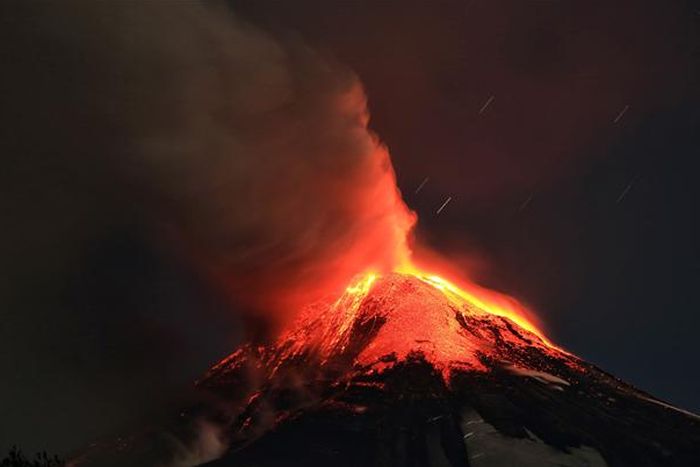
Villarrica Rucapillán Volcano Eruption, Araucania Region, Andes, Chile
|
In the two last weeks of February 1964 Villarrica produced small, violent lava effusions and tremors. On 1 March, at 2:45 am, it begun a strombolian eruption, and residents of Coñaripe, a wood-logging town, fled to the surrounding hills. Melting snow and ice from the Pichillancahue-Turbio Glacier combined with heavy rainfall to produce several lahars. Coñaripe, on the north-western shores of Calafquén Lake, had about half of its buildings destroyed, necessitating reconstruction further east.
• 1971 eruption
On 29 October 1971, at 4:00 am, there were several explosions in the crater and a column of black and white smoke appeared. One month later, at quarter to midnight on 29 December, Villarrica begun a new eruptive cycle. Pyroclasts were ejected and the snow surrounding the crater melted. After a brief halt in activity lava pored from a new vent on the north-east side, melting considerable amounts of water and causing lahars. These lahars affected Pichaye, El Turbio, Collentañe, Minetué, Molco, Voipir and Curarrehue, all of them in the Trancura River basin. In the larger settlements of Villarrica and Pucón, toxic sulphurous gases made the air unbreathable, and at least 15 deaths were reported.
|
|