|
|
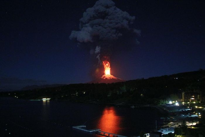
Villarrica Rucapillán Volcano Eruption, Araucania Region, Andes, Chile
|
The upper part of Villarrica is permanently covered by snow and has some 40 km2 of glaciers, the largest of which is the Pichillancahue-Turbio Glacier situated on its southeastern flank. Ash from the eruptions can increase the ablation of snow and ice by absorption of solar radiation. Some ash coverings are thicker than 5 cm and insulate the glacier, decreasing ablation instead of enhancing it. Between 1961 and 2003, Villarrica lost 25% of its glaciated surface and the glaciers shrank at an average rate of -0.4 km2 each year.
Tourism
Villarrica is popular for climbing with guided hikes to the crater from the town of Pucón, but these may be suspended due to cloud or volcanic activity. Helicopter over-flights have been available since 2007. In the winter (July–September) a ski resort operates on the northern slopes.
|
|