|
|
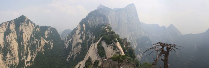
Hua Shan Hiking Trail, Huayin, Shaanxi Province, China
|
The Summits
Traditionally, only the giant plateau with its summits to the south of the peak Wuyun Feng (五雲峰, Five Cloud Summit) was called Taihua Shan (太華山, Great Flower Mountain). It could only be accessed through the ridge known as Canglong Ling (蒼龍嶺, Dark Dragon Ridge) until a second trail was built in the 1980s to go around Canglong Ling. Three peaks were identified with respective summits: the East, South, and West peaks.
The East peak consists of four summits. The highest summit is Zhaoyang Feng (朝陽峰, Facing Yang Summit, i.e. the summit facing the sun). Its elevation is reported to be 2096.2 meters and its name is often used as the name for the whole East Peak. To the east of Zhaoyang Feng is Shilou Feng (石樓峰, Stone Tower Summit), to the south is Botai Feng (博臺峰, Broad Terrace Summit) and to the west is Yunű Feng (玉女峰, Jade Maiden Summit). Today, Yunű Feng considered its own peak, most central on the mountain.
|
|