|
|
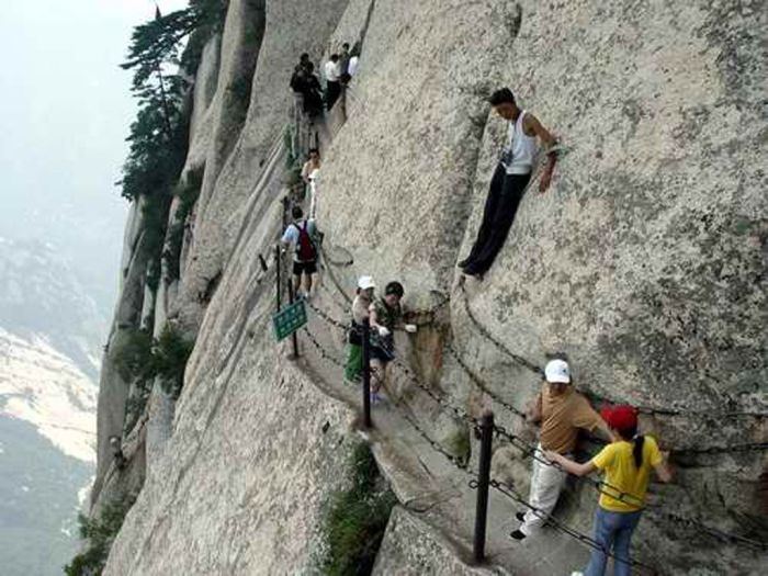
Hua Shan Hiking Trail, Huayin, Shaanxi Province, China
|
The South peak consists of three summits. The highest summit is Luoyan Feng (落雁峰, Landing Goose Summit), with an elevation of 2154.9 meters. To the east is Songgui Feng (松檜峰, Pines and Junipers Summit), and to the west is Xiaozi Feng (孝子峰, Filial Son Summit).
The West peak has only one summit and it is known as Lianhua Feng (蓮花峰) or Furong Feng (芙蓉峰), both meaning Lotus Flower Summit. The elevation is 2082.6 meters.
With the development of new trail to Hua Shan in the 3rd through 5th century along the Hua Shan Gorge, the peak immediately to the north of Canglong Ling, Yuntai Feng (雲臺峰, Cloud Terrace Peak), was identified as the North peak. It is the lowest of the five peaks with an elevation of 1614.9 meters.
|
|