|
|
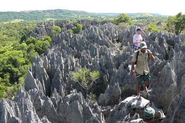
Stone Forest In Madagascar, Manambulu - Bemaraha
|
Geography
At 592,800 square kilometres (228,900 sq mi), Madagascar is the world's 47th-largest country and the fourth-largest island. The country lies mostly between latitudes 12°S and 26°S, and longitudes 43°E and 51°E. The prehistoric breakup of the supercontinent Gondwana separated the Madagascar-Antarctica-India landmass from the Africa-South America landmass around 135 million years ago. Madagascar later split from India around 88 million years ago, allowing plants and animals on the island to evolve in complete isolation.
The island of Madagascar can be divided into three broad geographic zones. These include the highlands, a plateau region in the center of the island ranging in altitude from 750 to 1,500 m (2,460 to 4,920 ft) above sea level; a narrow and steep escarpment that runs the length of the eastern coast and contains much of the island's remaining tropical rain forest; and a wide, dry plain that gently slopes from the western boundaries of the highlands toward the Mozambique Channel. The central highlands, traditionally the homeland of the Merina people (the island's most numerous ethnic group) and location of their historic capital at Antananarivo, is the most densely populated part of the island and is characterized by terraced, rice-growing valleys lying between grassy, deforested hills. There, erosion has exposed the island's red laterite soil, source of the country's sobriquet "The Red Island". Madagascar's highest peaks arise from three prominent highland massifs: Maromokotro 9,436 ft (2,876 m) in the Tsaratanana Massif is the island's highest point, followed by Boby Peak 2,658 m (8,720 ft) in the Andringitra Massif and Tsiafajavona 2,643 m (8,671 ft) in the Ankaratra Massif. To the east, the Canal des Pangalanes is a chain of man-made and natural lakes connected by French-built canals just inland from the east coast, running parallel to it for some 600 km (370 mi). The western and southern sides, which lie in the rain shadow of the central highlands, are home to tropical dry forests, thorn forests, and deserts and xeric shrublands. Presumably due to relatively lower population densities, Madagascar's dry deciduous rain forest has been better preserved than the eastern rain forests or the original woodlands of the high central plateau. The western coast features many protected harbors, but silting is a major problem caused by sediment from the high levels of inland erosion carried by rivers crossing the vast western plains.
|
|