|
|
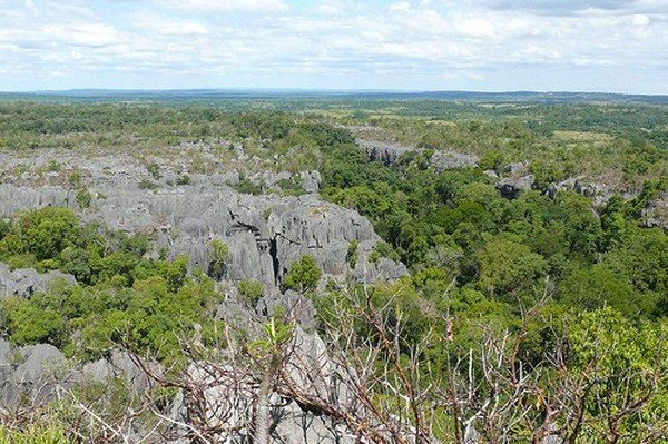
Stone Forest In Madagascar, Manambulu - Bemaraha
|
In the Malagasy language, the island of Madagascar is called Madagasikara /madaɡasʲˈkʲarə̥/ and its people are referred to as Malagasy. However, the island's appellation "Madagascar" is not of local origin but rather was popularized in the Middle Ages by Europeans. The name Madageiscar was first recorded in the memoirs of 13th-century Venetian explorer Marco Polo as a corrupted form of the name Mogadishu, the Somalian port with which Polo had confused the island. On St. Laurence's Day in 1500, Portuguese explorer Diogo Dias landed on the island and christened it São Lourenço, but Polo's name was preferred and popularized on Renaissance maps. No single Malagasy-language name predating Madagasikara appears to have been used by the local population to refer to the island, although some communities had their own name for part or all of the land they inhabited.
Geography
At 592,800 square kilometres (228,900 sq mi), Madagascar is the world's 47th-largest country and the fourth-largest island. The country lies mostly between latitudes 12°S and 26°S, and longitudes 43°E and 51°E. The prehistoric breakup of the supercontinent Gondwana separated the Madagascar-Antarctica-India landmass from the Africa-South America landmass around 135 million years ago. Madagascar later split from India around 88 million years ago, allowing plants and animals on the island to evolve in complete isolation.
|
|